
Electrical Resistivity
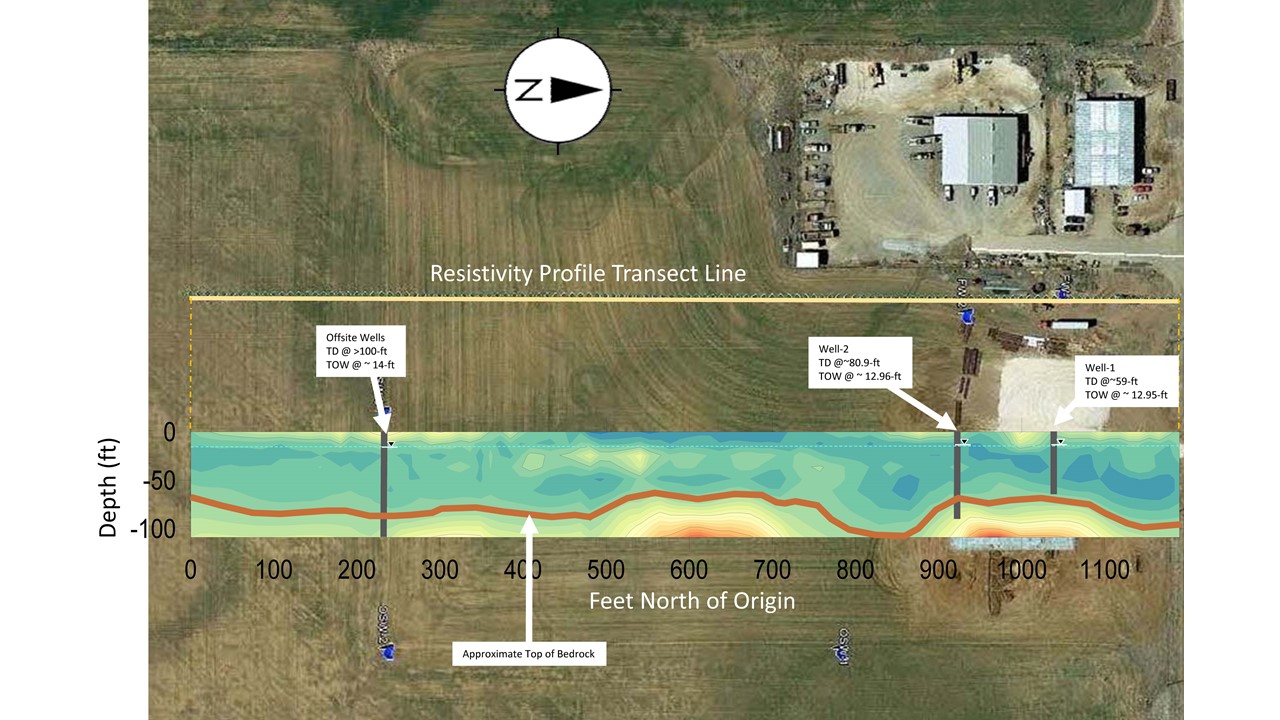
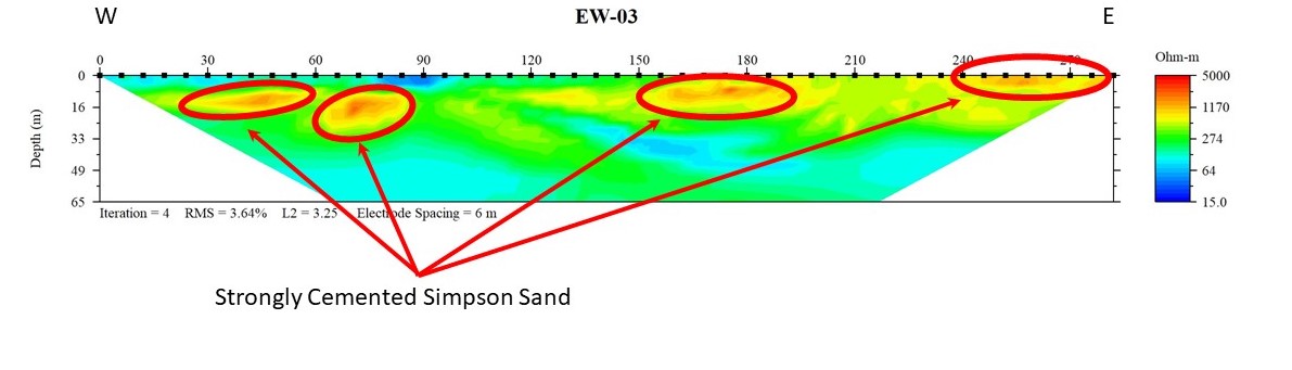
Electrical resistivity tomography images the subsurface based on electrical properties of soil, rock and pore fluids. Electrical current is injected via an electrode array to produce 2D and 3D images of the electrical properties of the subsurface. Data can be processed and viewed in near real time. These images are interpreted to produce cross sections that display:
- Soil and Bedrock Lithology
- Contaminant Plumes
- Aquifer Character
- Water Table Depth
- Bedrock Topography
- Fracture, Fault and Karst Characteristics


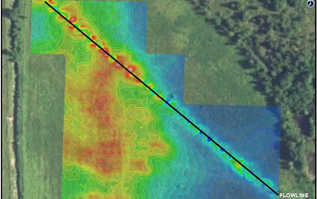
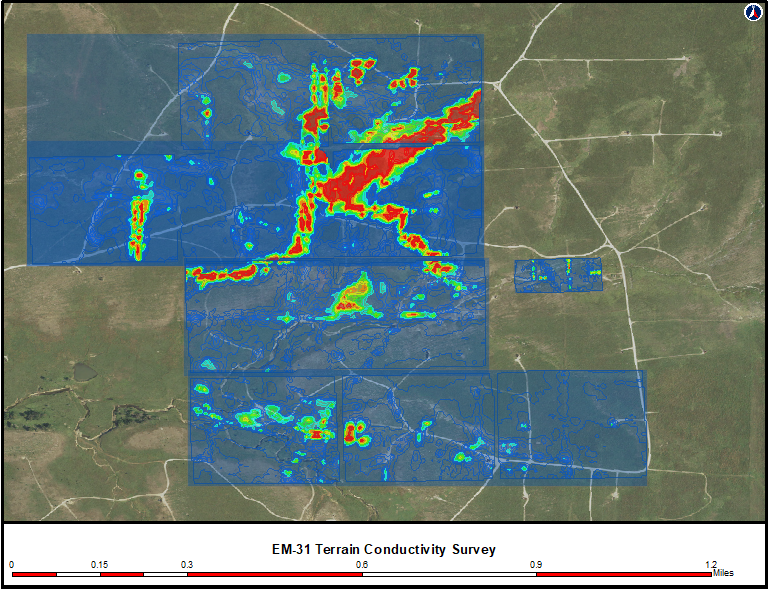
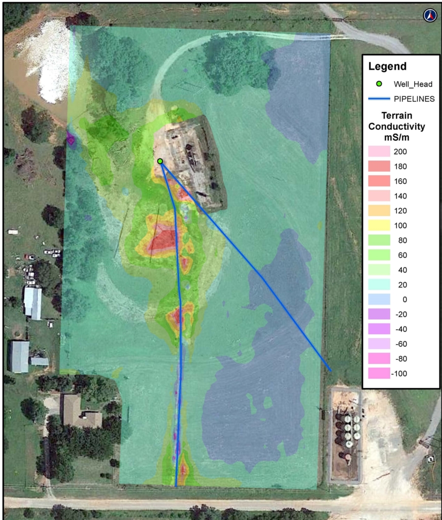
Electromagnetic (Conductivity) Survey
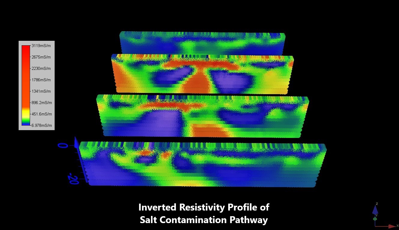
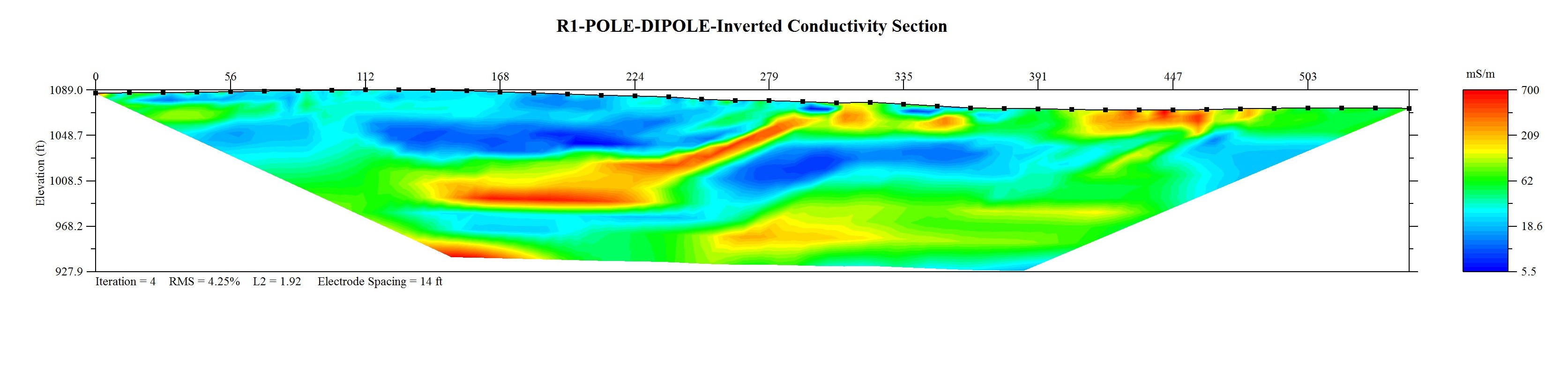
Electromagnetic (EM) Surveys use the principle of electromagnetic induction to measure the conductivity of the subsurface based on soil properties and chemistry of pore fluids. EM Surveys do not require ground contact and therefore allow rapid data acquisition. Data can be processed and viewed in near real time.
Applications:
- Lithology Mapping
- Contaminant Plumes (Especially Salt)
- Boundaries of Waste Pits and Ponds
- Buried Object Locations (UST, Drums, Pipelines)
- Utility Mapping
- Aquifer Characterization
- Fractures, Faults, and Karst mapping
Gravity
Gravity instruments measure the change in the earth’s gravitational field caused by variations in the density of the subsurface and are used to detect and map buried structures such as faults, voids, bedrock topography, and basin geometry. The data can be used to determine size, depth, shape, and composition of subsurface features. Typical applications include:
- Karst Features
- Voids and Tunnels
- Valley Fills and Subsurface Topography
- Faults and other Geologic Structure
- Sinkhole Detection
- Abandoned Mine Location
- Construction & Infrastructure Consultation
Ground Penetrating Radar (GPR)
GPR measures changes in the propagation of electromagnetic energy in the subsurface. The electromagnetic signal is reflected when electrical properties of the subsurface change. A GPR unit comprises a transmitting and receiving antenna that induce the signal and record the reflected data. Data is collected digitally and can be viewed in real time; 2D and 3D images can be produced that display:
- Buried Objects (drums, USTs)
- Utilities
- Concrete and Rebar
- Voids
- Subsurface Structures
- Waste pits, trenches, etc.
- Fractures, Faults, & Karst
- Archeological Artifacts


Magnetic Methods
Magnetic methods measure the earth’s magnetic field and anomalies caused by natural and manmade magnetic materials. Magnetic methods can be particularly useful to image:
- Buried Metal Objects
- Utilities
- Pipelines
- Abandoned Wells
- Faults and other Structures
- Archeological Artifacts
Shallow Seismic
Seismic methods measure the elastic properties of soil and rock. These properties depend on mechanical attributes of soils and rocks such as density and various elastic moduli. Various seismic methods can be employed to characterize:
- Overburden Thickness
- Bedrock Topography
- Water Table Depth
- Bedrock Toughness
- Lithology
- Fractures, Faults, & Karst

