
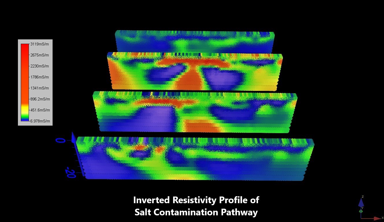
Environmental
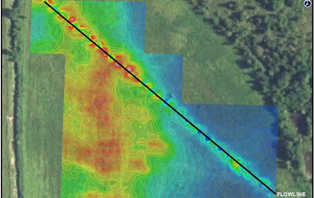
Characterizing subsurface conditions is a necessary component of environmental site assessment and remediation projects. Lithochimeia’s geophysical capabilities provide insight into extent of contamination, significantly increase the cost-effectiveness of remediation design, and monitor continuing effectiveness of project approach.
Environmental Applications Include:
- Soil and Groundwater Contaminant Plume Delineation
- Boundaries of Waste Pits and Ponds
- Aquifer Characterization
- Lithology Mapping
- Buried Object Location (UST, Drums, Pipelines)
- Utility Mapping
- Sample and Bore Hole Optimization
- Remediation Monitoring
- 2D, 3D and 4D Imaging
Geophysical Methods in Environmental Applications:
- Electrical Resistivity Profiling
- GPR
- Electrical Conductivity Mapping
- Magnetics
- Shallow Seismic Imaging
- Borehole Geophysics
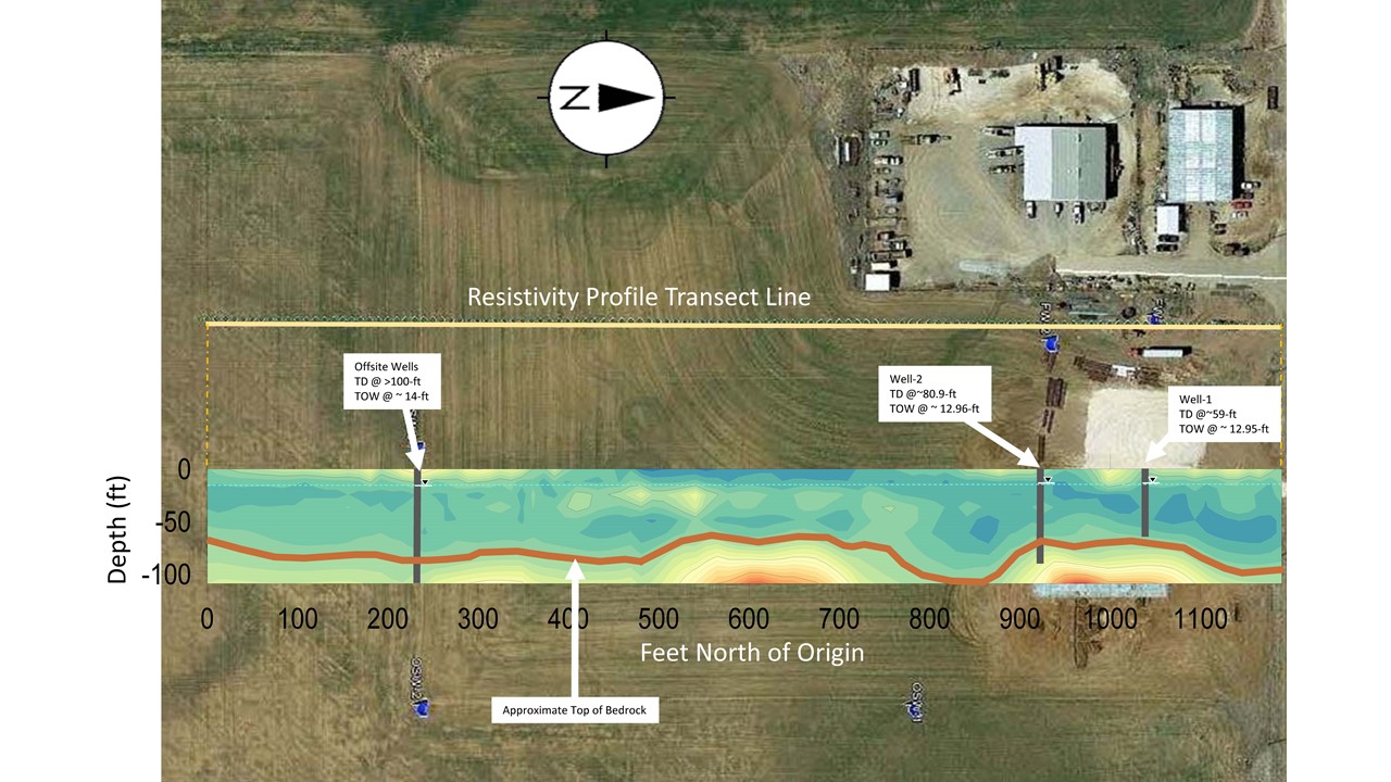
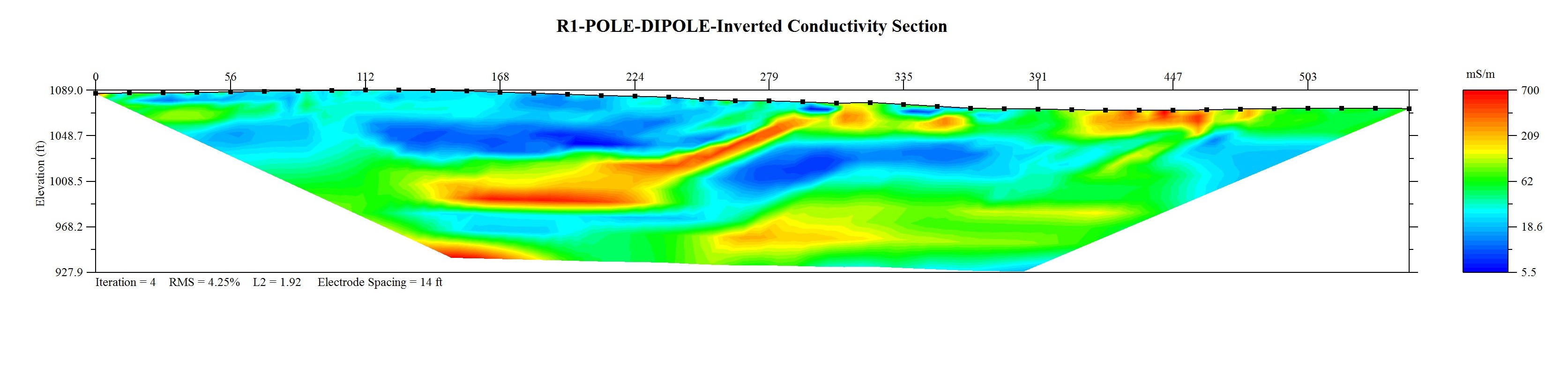
Groundwater
Lithochimeia uses geophysics to detect, characterize and map groundwater to estimate groundwater availability, quality and to optimize water well placement and design.
Groundwater Applications:
- Lithology Mapping
- Aquifer Characterization
- Water Table Depth
- Overburden Thickness
- Bedrock Topography
- Fractures, Faults and Karst Mapping
- Saline Groundwater Detection
- Optimization of Monitoring and Production Wells
- 2D and 3D Imaging
Geophysical Methods in Groundwater
- Electrical Resistivity
- Electrical Conductivity
- Magnetics
- Gravity
- Borehole Geophysics
- Shallow Seismic Imaging
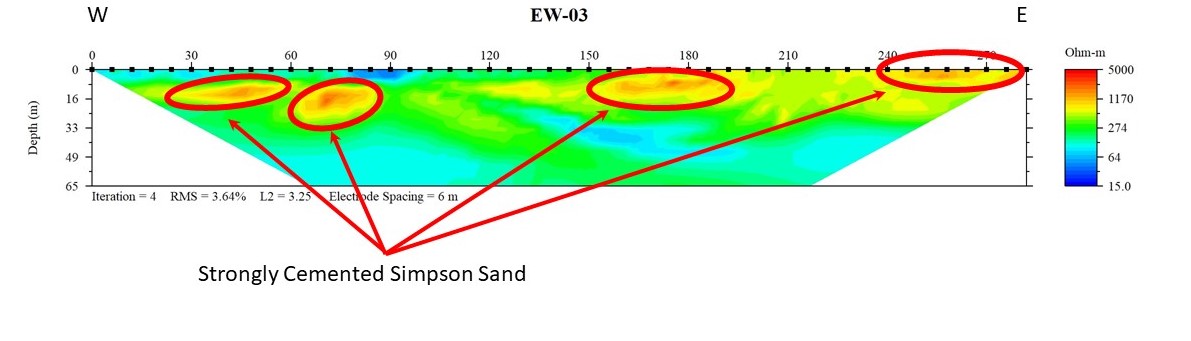
Mining & Construction
Lithochimeia uses geophysics to map economic lithologies and characterize subsurface hazards to construction.
Mining and Construction Applications Include:
- Sand Body Mapping
- Differential Cementation Mapping
- Fractures, Faults and Karst Mapping
- Near Surface Lithology
Geophysical Methods in Mining and Construction:
- Electrical Resistivity
- Electrical Conductivity
- Shallow Seismic Imaging
- Magnetics
- Gravity
- GPR

